")
")
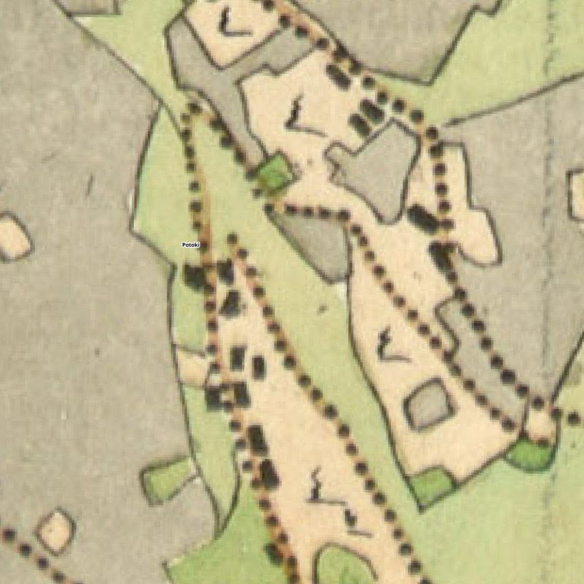
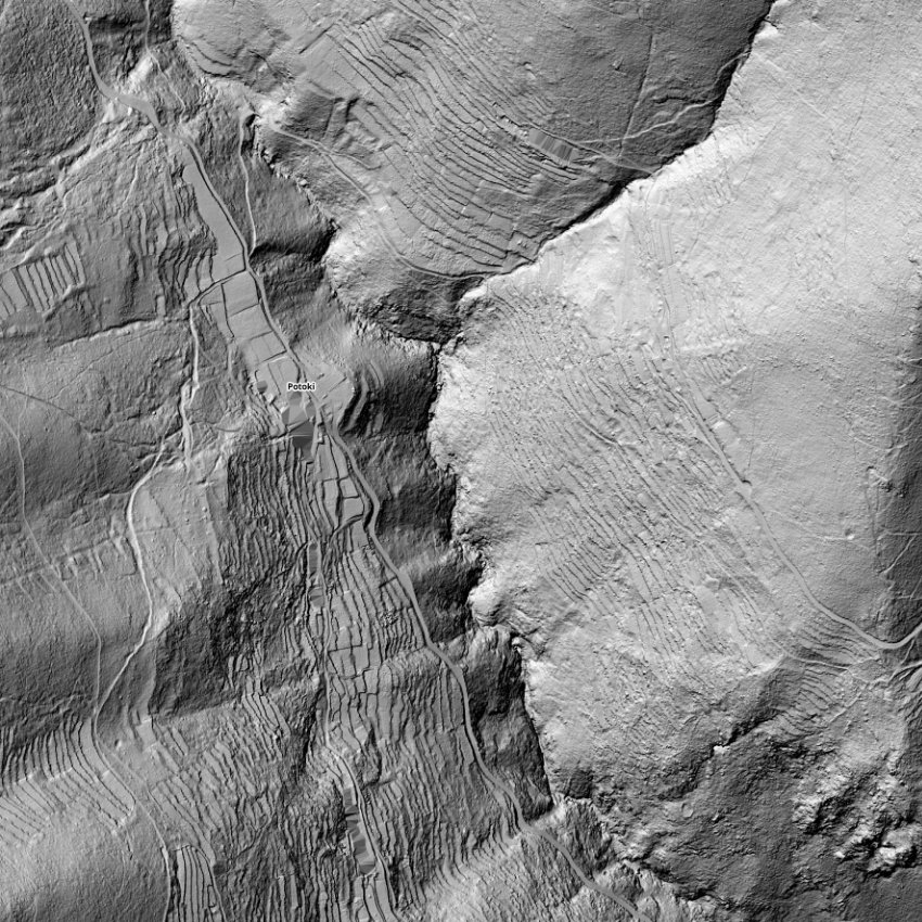
The village of Potoki is located in a partially sheltered position relatively deep in the canyon, on the gently inclined part of the western slopes. It has enough sunlight and is close to the streambed, which ensures all the necessary conditions for it to function. The landscape of Potoki is interspersed with dry stone terraces that run parallel to the streambed, with buildings located along them. The houses were built in a row following the direction of the streambed, and there are terraces with outbuildings located next to them. On the terraces next to the houses, there are still several cultivated gardens and vineyards, as well as meadows and pastures, although most of them have been abandoned and covered with overgrowth. The real picture of the former village and its agricultural landscape can be seen from the historical cadastre and the present-day Lidar image, which reveal a significantly larger area of dry stone terraces used for agriculture.