")
")
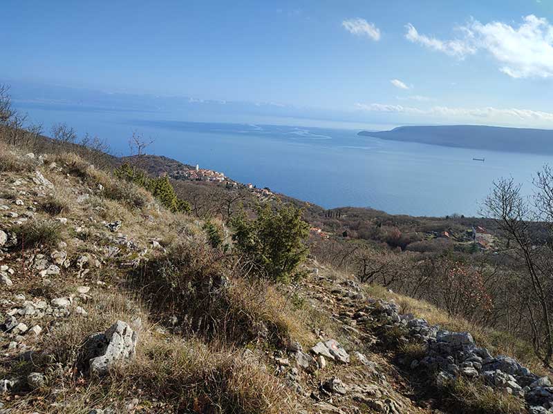
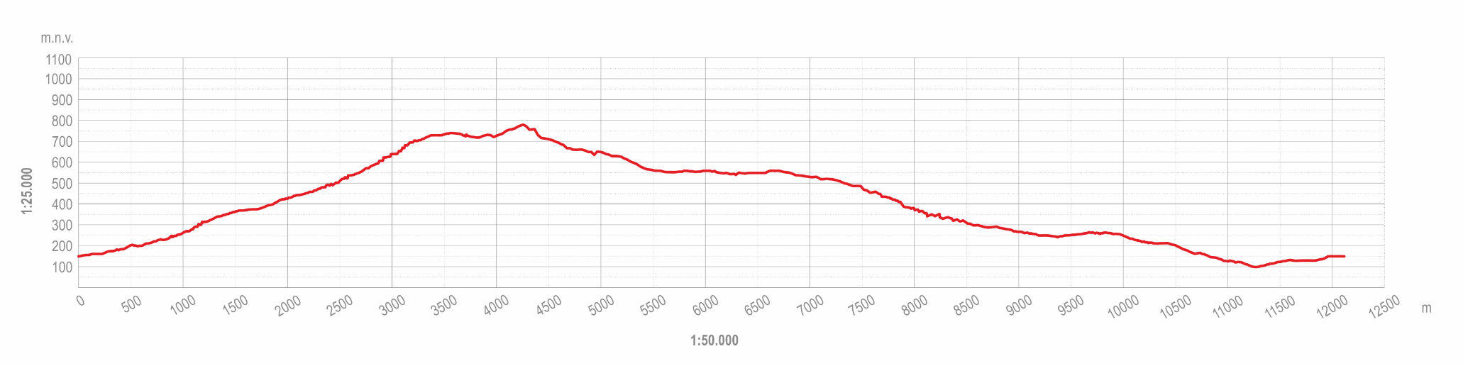
This itinerary is a 12.5-km-long demanding hiking trip with a cumulative increase in elevation of approximately 900 m. It is suitable for experienced hikers and recreationists in very good condition. Considering the steepness, exposure and technically demanding parts of the trail, special attention should be paid to weather conditions, adequate clothing and equipment, and having enough water to drink. The aim of the itinerary is to introduce visitors to the landscape of the Brseč area and the mountain ridge of Sisol. The estimated walking time is 8 hours.
The route starts from the centre of Brseč along the existing hiking trail to Sisol. After crossing the D66 state road, the route leads to the hamlet of Carići, from where it ascends to the site of Grabrova, where a small picnic area is planned. The route then ascends to the Provrtenica ‘half-cave’ and follows Sisol Ridge northwards to the Prodol Pass. From there, the trail turns east to the Rovozna Valley and an ornithological centre. Here, the itinerary separates from the hiking trail and descends to Golovik along neglected historical paths. The route then continues along an overgrown historical path via Marinov Breg to the hamlet of Blažići, where it joins the previously defined Illyrian Walk educational path, along which it descends to the D66 state road and returns to Brseč via Brseč Plain.
Shorter trips along this itinerary are also possible, such as a visit to the Brsečka Grabrova site or a climb to Vela Ozida.